
Imagine a horseshoe-shaped zone wrapping around the Pacific Ocean, where 75% of the world’s volcanoes and 90% of earthquakes occur. This geologic powerhouse isn’t a mythical creation—it’s a real-world marvel shaped by colliding tectonic plates. Known for its intense seismic activity, this belt stretches over 40,000 kilometers, linking regions like Japan, Indonesia, and the Americas.
What fuels this dynamic region? The answer lies in subduction zones, where one tectonic plate slides beneath another. This process melts rock, creating magma that erupts as volcanoes or triggers earthquakes. While often called a “ring,” the zone is actually a series of fragmented arcs and clusters—not a perfect circle.
From devastating tsunamis to ash-covered skies, this area’s geologic forces impact millions globally. For countries like India, understanding these patterns is vital, as neighboring regions (like Indonesia) lie within the belt. Upcoming sections will explore how these movements shape landscapes and influence disaster preparedness.
Key Takeaways
- A massive geologic belt with most of Earth’s volcanoes and earthquakes
- Driven by tectonic plate collisions called subduction zones
- Forms a broken horseshoe shape rather than a complete ring
- Affects countries across Asia, the Americas, and Oceania
- Critical for understanding natural disaster risks worldwide
Overview and Geological Significance
Why does this region experience such intense geological activity? The answer lies in its unique position along colliding tectonic plates. Approximately 90% of global earthquakes and two-thirds of active volcanoes cluster here, making it Earth’s most explosive laboratory. These forces don’t just shape mountains—they rewrite coastlines and influence climates worldwide.
At the heart of this dynamism are subduction zones, where one plate dives beneath another. This process melts rock into magma, fueling eruptions and tremors. For instance, Japan’s iconic Mount Fuji and Indonesia’s Krakatoa owe their existence to these underground collisions. The belt’s relentless energy has built island chains, carved trenches, and triggered tsunamis over millions of years.
Scientists study this area to decode patterns in volcanic activity and earthquakes. Their findings help predict disasters, safeguarding communities in India and beyond. From the Andes to the Aleutians, the belt’s legacy is etched into every eruption and aftershock—a testament to our planet’s ever-changing surface.
Formation Through Plate Tectonics
What drives the Earth’s most explosive geologic events? The answer lies in the slow but relentless dance of tectonic plates. These massive slabs of Earth’s crust collide, separate, and slide past each other, creating the conditions for volcanoes and earthquakes. The region’s structure stems from three main types of plate boundaries: convergent, divergent, and transform.
At convergent boundaries, plates crash head-on. When oceanic plates meet continental ones, the denser slab dives downward in a process called subduction. This action melts rock into magma, fueling volcanic arcs like the Cascades in North America. The Juan de Fuca Plate’s descent beneath the continent illustrates this perfectly.
Meanwhile, divergent boundaries pull plates apart, forming rift zones and mid-ocean ridges. Though less explosive, these areas release tension through frequent smaller quakes. Transform boundaries, like California’s San Andreas Fault, grind sideways, triggering major earthquakes without volcanic activity.
Over millions of years, these interactions built the belt’s fractured landscape. The Pacific Plate’s westward push and the Nazca Plate’s rapid subduction under South America continue reshaping coastlines today. Understanding these movements helps scientists predict risks for nearby regions, including India’s neighbors.
Understanding the Pacific Ring of Fire
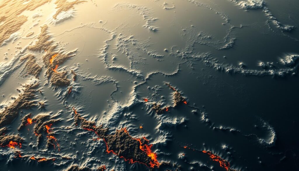
Spanning 40,000 kilometers, this seismic belt forms a fractured arc around the Pacific Ocean, linking continents through shared geologic drama. Its path touches South America‘s volcanic Andes, North America’s Cascade Range, and island chains like Japan and Indonesia. Though often visualized as a continuous loop, the zone comprises segmented sections with distinct tectonic behaviors.
Collisions between oceanic and continental plates dominate this region. The Nazca Plate diving beneath South America creates explosive volcanoes like Cotopaxi, while the Philippine Sea Plate’s grind against Eurasia fuels Japan’s frequent quakes. These interactions produce 452 active volcanoes and thousands of tremors annually across the basin.
What makes this belt so varied? Its scale crosses multiple climate zones and crust types. Coastal Chile experiences megathrust earthquakes, while Alaska’s Aleutian Islands showcase plates sliding sideways. This diversity challenges scientists to develop localized prediction models—critical for India, as neighboring Myanmar and Indonesia face regular eruptions.
Understanding this region’s layout helps explain why Tokyo has earthquake-resistant skyscrapers or why Chile monitors its coast for tsunamis. For learners, maps reveal how the Pacific Ocean’s edges hide Earth’s most powerful geologic engines—constantly reshaping continents through fire and motion.
Historical Interpretations and Naming Conventions
Long before modern science, cultures worldwide saw smoking mountains as proof of a living, fiery Earth. Ancient Hawaiians believed eruptions were Pele’s wrath, while Greek myths attributed volcanic activity to Hephaestus’ forge. These stories tried to explain what early scientists later called “burning mountains”—a term reflecting limited understanding of tectonic forces.
In the 19th century, geologists like G.P. Scrope studied dormant volcanoes to decode eruption patterns. His work, alongside Jules Michelet’s vivid writings, transformed public perception. Michelet’s poetic “Ring of Fire” description stuck, evolving from metaphor to scientific shorthand for the Pacific’s volcanic belt.
Major eruptions fueled legends and scientific progress alike. The 1883 Krakatoa explosion—heard 4,800 km away—inspired global interest in geologic activity. Similarly, Japan’s Mount Fuji, dormant since 1707, remains a cultural icon studied for clues about future risks.
Today, researchers analyze ash layers and historical records to predict eruptions since ancient times. This blend of myth and measurement helps nations like India prepare neighboring regions for disasters. What began as tales of angry gods now drives earthquake-resistant architecture and early warning systems.
Subduction Zones and Volcanic Arcs
Beneath the ocean’s surface, a hidden dance of tectonic plates fuels Earth’s most explosive landscapes. When one plate slides under another—a process called subduction—it melts into magma. This molten rock rises through cracks, building chains of volcanoes known as volcanic arcs.
The Mariana Arc near Japan showcases this perfectly. Here, the Pacific Plate dives beneath the Philippine Sea Plate, creating deep trenches and islands like Guam. Similarly, the Aleutian Arc in Alaska forms where plates collide at a steep angle, producing frequent explosive eruptions.
Why do some arcs erupt violently while others ooze lava quietly? The answer lies in the subduction angle. Shallow angles create more friction, trapping water and gases that fuel explosive magma. Steeper angles allow smoother sinking, leading to gentler flows.
Beneath North America’s west coast, the Juan de Fuca Plate’s subduction builds the Cascade Range. Mount St. Helens and Mount Rainier stand as reminders of this ongoing process. Scientists monitor these zones closely, as shifting plates can signal impending eruptions or megaquakes.
Understanding volcanic arcs isn’t just geology—it’s lifesaving. For India, studying similar zones in Indonesia helps improve regional disaster preparedness. Each tremor and eruption teaches us more about Earth’s restless energy.
Seismic Activity and Earthquake Patterns
Earth’s crust shudders violently where tectonic giants collide, unleashing energy that reshapes continents. Nearly 90% of the world’s earthquakes occur here, including history-making events like the 1964 Alaska quake (magnitude 9.2) and Japan’s 2011 Tōhoku disaster. These tremors trace back to one source: clashing tectonic plates.
In the United States, the North American Plate grinds against the Pacific Plate along California’s San Andreas Fault. This friction causes frequent quakes, like the 1906 San Francisco tremor that reshaped cities. Further north, Alaska’s 1964 megathrust earthquake—the second-strongest ever recorded—occurred as the Pacific Plate dove beneath the American Plate.
Why do subduction zones produce such power? When plates converge, stress builds until rocks fracture. This releases waves of energy—sometimes with foreshocks and aftershocks lasting months. Scientists track these patterns using GPS and seismometers to predict risks.
Continuous monitoring helps communities prepare. Japan’s early warning systems, tested during the Tōhoku quake, now inspire similar tech in the United States. For India, understanding these seismic networks aids neighboring regions prone to tremors.
From California to Chile, the dance of plates reminds us: Earth’s surface is always moving. By decoding its rhythms, we build safer futures.
Major Volcanic Eruptions: Case Studies
Volcanic explosions rewrite landscapes in minutes—but what do these events teach us? The 1980 eruption of Mount St. Helens offers a textbook example. After months of seismic activity, the volcano blew sideways, flattening 600 km² of forest. This disaster revealed how magma buildup and tectonic stress can trigger catastrophic collapses.
In Central America, the Trans-Mexican Volcanic Belt showcases another explosive pattern. Popocatépetl, one of its active peaks, has erupted over 20 times since 1994. These events highlight how gas-rich magma interacts with subducting plates, creating both slow lava flows and sudden ash clouds.
The St. Helens blast wasn’t just about fire—it involved a massive landslide. Rockslide debris mixed with melted snow, causing destructive mudflows. Similarly, Mexico’s Colima Volcano combines seismic activity with pyroclastic surges, challenging nearby communities.
Lessons from these eruptions shape modern monitoring. Scientists now track ground deformation and gas emissions alongside quakes. For India, understanding such systems aids neighboring regions like Indonesia, where similar risks exist. Each eruption writes a new chapter in Earth’s geologic playbook—one we’re learning to read faster than ever.
Geographic Distribution and Regional Features
Diverse landscapes, from New Zealand’s steaming valleys to North America’s towering peaks, reveal a hidden network of geologic power. This belt’s volcanoes and faults cluster in distinct regions, each shaped by unique tectonic forces.
In New Zealand, the Taupō Volcanic Zone hosts explosive supervolcanoes fueled by the Pacific Plate’s collision with the Australian Plate. Contrast this with North America’s Cascade Range, where the Juan de Fuca Plate dives beneath the continent, creating iconic peaks like Mount Rainier.
The Aleutian Islands tell another story. Here, plates slide sideways, producing frequent earthquakes and ash-spewing stratovolcanoes. These variations show how local geology shapes hazards—explosive eruptions in one area, slow lava flows in another.
Why does this matter? Understanding regional differences helps communities prepare. For India, studying neighboring zones like Indonesia’s volcanoes offers insights into disaster resilience. From the Juan de Fuca’s silent shifts to the Aleutian Islands’ rumblings, geography holds the key to decoding Earth’s restless energy.
Plate Boundaries: Convergent, Divergent, and Transform
Three distinct plate interactions shape Earth’s most active geologic belt. Convergent boundaries dominate here, where colliding plates force one slab beneath another. This subduction melts rock into magma, fueling volcanic arcs like Chile’s Andes Mountains. The Nazca Plate’s plunge under South America exemplifies this explosive process.
At divergent boundaries, plates pull apart. Molten magma rises through gaps, forming underwater ridges like the East Pacific Rise. Though less explosive, these zones release constant tectonic stress through frequent small quakes.
Transform boundaries add another layer of complexity. Here, plates grind sideways—like California’s San Andreas Fault—creating powerful earthquakes without volcanic activity. This lateral motion redistributes energy across the region’s fractured crust.
Why does this matter? The interplay between these boundaries dictates where volcanoes erupt or cities shake. Japan’s volcanic islands emerge from convergent tectonics, while Alaska’s transform zones trigger tsunamis. Understanding these patterns helps scientists predict risks for neighboring regions like Indonesia—critical knowledge for India’s disaster preparedness strategies.
From magma-rich subduction zones to slipping transform faults, each boundary type leaves a unique fingerprint on the landscape. Together, they form a dynamic system that keeps Earth’s crust in constant motion.
Statistical Insights and Research Data
Numbers don’t lie—this belt generates staggering geologic statistics that redefine “active.” Recent studies reveal that active volcanoes here erupt 10-15 times monthly, compared to 1-2 eruptions elsewhere. Over 80% of magnitude 8+ quakes since 1900 originated within ring fire zones, reshaping how scientists assess global risks.
Out of Earth’s 1,350 potentially active volcanoes, 452 sit within ring boundaries. That’s 33% concentrated in just 5% of the planet’s surface area. For comparison, Africa—three times larger—hosts only 16% of the world’s volcanic peaks. This imbalance highlights the belt’s unique geologic intensity.
Seismic activity ring fire regions average 30,000 detectable earthquakes yearly. Japan alone records 1,500 tremors annually, while Chile’s subduction zone triggers 18% of global quakes. Data trends show eruptions here release 70% more sulfur dioxide than non-belt volcanoes, influencing climate patterns worldwide.
Modern monitoring tools now track plate movements down to millimeters. GPS data confirms the Philippine Plate shifts 6-8 cm yearly toward Eurasia—a motion directly linked to increased activity ring fire hotspots. For India, such insights aid disaster planning in neighboring nations like Indonesia, where 127 active volcanoes threaten millions.
Impact on the Environment and Human Societies
The restless movement of tectonic plates doesn’t just reshape land—it transforms lives. Along the pacific plate boundaries, ecosystems face constant upheaval. Volcanic ash enriches soil but smothers forests, while earthquakes trigger landslides that redirect rivers. Coral reefs in Indonesia’s zones suffer from tsunami damage, disrupting marine biodiversity that millions rely on for food.
Coastal cities worldwide grapple with dual threats: sudden quakes and slow-sinking land. Tokyo’s skyscrapers sway during tremors, while Chile’s ports rebuild after repeated tsunamis. Farmers near active volcanoes face ruined crops from ashfall, yet volcanic soil also supports thriving coffee plantations in Central America.
Economic losses from eruptions and quakes exceed $30 billion annually globally. Tourism collapses when airports close due to ash clouds, as seen during Bali’s 2017 Agung eruption. Conversely, geothermal energy harnessed from volcanic zones powers entire cities in Iceland and New Zealand.
Scientists now deploy drones to monitor gas emissions and AI to predict quakes seconds faster. Communities from Japan to Mexico conduct regular evacuation drills. International projects like the world’s largest seismic sensor network help nations share real-time data—a lifeline for India’s disaster-prone neighbors.
Survival here means balancing risk with resilience. From reinforced schools in Alaska to smartphone alert systems in Jakarta, innovation thrives where Earth shakes hardest.
Future Directions in Geological Monitoring
Cutting-edge sensors now peer deep beneath Earth’s surface, transforming how we predict volcanic eruptions and earthquakes. Along the Andes Mountains, fiber-optic cables detect ground vibrations 20 times faster than traditional seismometers. These systems map magma movements with unprecedented detail, offering earlier warnings for communities below.
In North American regions, scientists deploy AI to analyze decades of seismic data. One project tracks the Juan de Fuca Plate beneath North America’s west coast, predicting stress buildup along fault lines. Collaborative efforts between NASA and universities use satellite radar to measure ground shifts as small as a millimeter.
Challenges remain in areas like the Andes Mountains, where steep terrain complicates sensor placement. New drone-mounted gas analyzers now sample volcanic plumes remotely, reducing risks for researchers. Meanwhile, international teams share real-time data through platforms like the Global Volcano Model network.
Improved forecasting could revolutionize disaster response worldwide. For India, advancements in monitoring beneath North Pacific zones help neighboring countries prepare faster. As technology bridges gaps between lab research and field operations, our ability to read Earth’s warnings grows sharper every year.
Conclusion
Earth’s most volatile geologic zone continues to shape landscapes and human societies through relentless tectonic activity. This horseshoe-shaped belt—home to 75% of volcanoes and 90% of earthquakes—reveals how colliding tectonic plates create subduction zones that fuel eruptions and tremors. From ancient myths to modern monitoring systems, our understanding of these forces has evolved into life-saving science.
Communities bordering this zone face constant challenges, yet their resilience inspires global disaster preparedness strategies. Researchers now combine historical records with satellite technology to predict risks, while nations invest in earthquake-resistant infrastructure. For India, studying neighboring seismic hotspots provides crucial insights for regional safety measures.
This dynamic region reminds us that geologic processes connect us all. By unraveling its secrets, we gain tools to protect vulnerable populations and appreciate Earth’s awe-inspiring power. The ongoing dance of tectonic plates challenges humanity to innovate while respecting nature’s might—a lesson echoing from laboratories to living rooms worldwide.